Doing a digital humanity project is basically a process to find the information hiding in the back of other information. In the most basic transcription work, we are extracting text from the image. Then, we extract statistics from text using voyage tools. Now we are trying to extract the interactions between places and people using a GIS map. These information is always hidden and we are hard to know its importance util we pop it out.
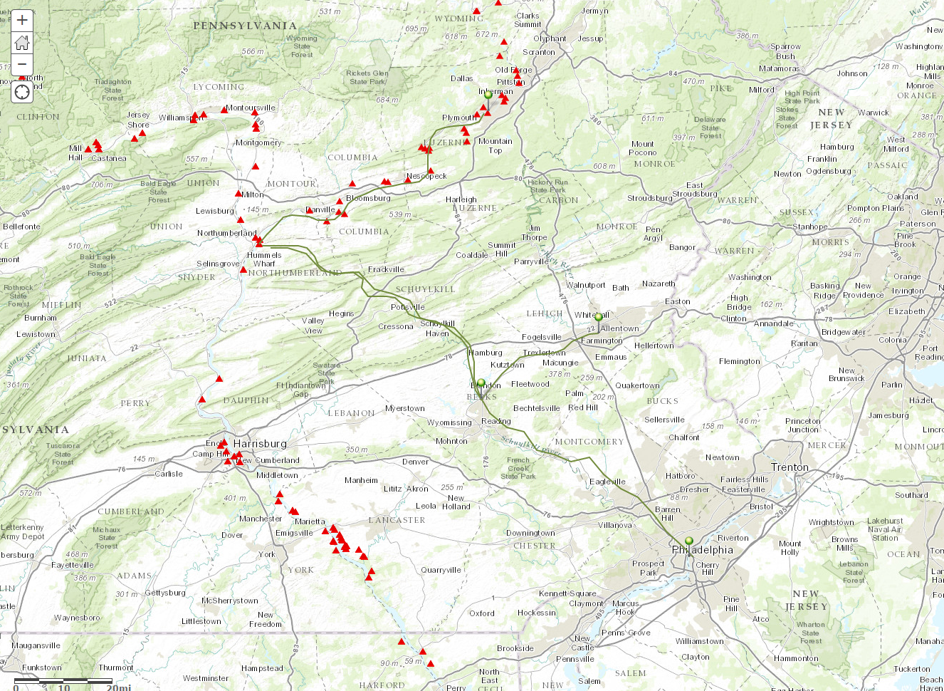
I did a research on Powell diary using the GIS tool. I tried to extract some information from the routes connecting Shamokin, the village where Joseph Powell lives, and other destinations. The first route is the waterway connecting Shamokin and Wyoming Vally: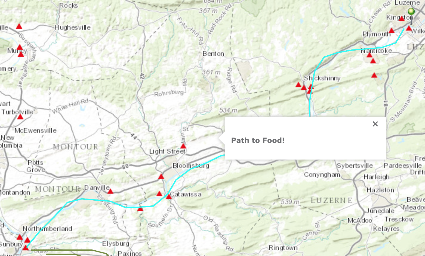 In Powell Diary, either indians or moravians visits this path several times. Some of them are visiting one of the villiage on this path and most of them forward to Wyoming valley by this path. Using the map, I am able to combine those different location-related events into this single path. From map, I find a really i
 nteresting fact, that alone this path, the native american sites’ density is much bigger than the other two branches.(red triangles are Native Americans’ sites) From some deeper research, I knew that Wyoming Valley was a major food resource for Native Americans at that place in 18th century. Therefore, I called the waterway as ‘Path to food’. In one hand, it explains why there are more tribes beside ‘Path to food’, and in another hand, it explains the importance of Shamokin. It was also the reason why Moravians chose to go to Shamokin first. Shamokin sited at a crossroad of the river. Both the tribes in the north branch and south branch need to pass by Shamokin to get in to the ‘Path of food’. As a ‘transfer stop’, Shamokin gathered different people and different culture. There are Moravians, Mohicans, Dellaware and traders. This diversity makes Shamokin an important place in central Pennsylvania.
GIS extracts information from the text. We are not creating information but discovering them. From the plain text, we are able to know about Shamokin’s importance but we need reduplicate reading to figure out why it is critical. Maybe moravians don’t want the readers of the diary know that they choose Shamokin to be an outpost because Shamokins’ strategic significance. However, GIS as an effective tool, easily extracts those hiding information and presents it to me.