For the past couple of weeks, our class has been collaborating on our sections of the Powell Diary in order to get enough information to build a GIS data dictionary. With the information that our class was able to collect through collaboration, we were able to determine the names and nicknames of the people and places in the Powell Diary. Once we had enough data to make a detailed GIS data dictionary, our class then each created our own story maps on the section of the Powell Diary that we had for our close readings. Finally, after creating our story maps, we were able to publish and share our maps through a web mapping application. In my story map, I attempted to show the places where people in the second Powell Diary came from to visit Shikalleme in Shamokin. In addition, through the mapping of Shikalleme’s interactions with other Indians located in various places on the east coast, we were able to show the importance of Shikalleme in his tribe along with other Indian tribes.
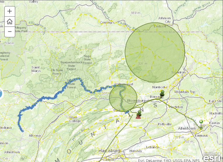
In David J. Bodenhamer’s article “The Potential of Spacial Humanities” he states “we are drawn to issues of meaning, and space offers offers a way to understand fundamentally how we order our world.” With the use of arcGIS, our class was able to support Bodenhamer’s statement. With the use of arcGIS I was able to get a much better picture of just how far various Indian tribes would come from to just visit with Shikalleme. In Bodenhamer’s article he states that “GIS is a seductive technology, a magic box capable of wondrous feats, and the images it constructs so effortlessly appeal to us in ways more subtle and more powerful than words can.” I think that when I did the close reading of the second Powell Diary, I believed that all of the people that visited Shikalleme were of close proximity to Shamokin. However, after the use of the GIS application, I learned that many of the Indians that visited Shikalleme were from very far away and in order to visit him they had to take voyages that could take several months to complete. In the image below, it shows the distance between Shamokin and Bethlehem. Although the two locations are only a few hours from each other by car, it could have taken up to month for anybody to reach Shamokin from Bethlehem on foot.
Although mapping is the most vital part of GIS, it is not the only element that is necessary. In order to make a comprehensive GIS file for publishing, images along with descriptions are needed for clarity. In my opinion, arcGIS is my favorite digital humanities application and I support Bodenhamer’s statement that space no longer has providential meaning, but in the process it has assumed a more interesting and active role in how we understand history and culture.”